
Lower Allen Township ZIP Coverage
Three ZIP codes have a documented Lower Allen Township connection in the research: 17011 through the Township's municipal address, and 17055 and 17070 through county-listed Lower Allen polling-place addresses. This evidence confirms postal use at those locations. It does not create an official Township-wide ZIP boundary map or prove that every street using one of the postal-community names lies within the Township. Verify the actual delivery address before using a ZIP as part of a records search.
| ZIP | Areas covered | Post office | Notes |
|---|---|---|---|
| 17011 | Camp Hill postal community | Verify individual delivery addresses with USPS. | The Township Municipal Services Center uses a Camp Hill 17011 mailing address. That does not place every 17011 address in Camp Hill Borough. |
| 17055 | Mechanicsburg postal community | Cumberland's Lower Allen polling-place page lists Lower Allen Fire Company #2 and Bethany Village addresses with this ZIP. | Verified Lower Allen facility and postal use, but each delivery address still needs USPS confirmation. |
| 17070 | New Cumberland postal community | Cumberland's Lower Allen polling-place page lists Link 4 Youth with this ZIP. | Verified Lower Allen facility and postal use, not a municipal-boundary claim for all 17070 deliveries. |
The coverage table is deliberately evidence-based. The gathered sources do not provide an exhaustive street-by-street delivery list or a municipal ZIP polygon. That limit matters most at the edge of a postal route, where a familiar town name can be accurate for mail but wrong for a parcel, polling, or Township records question.
Lower Allen Township ZIP Checks
Use the postal guide as a verification path rather than a resident list. The delivery check comes first. County GIS then answers the land and municipal question. Assessment and Recorder records answer different parcel and title questions. This sequence keeps a postal field from carrying more meaning than it has.
- Enter the complete address in the USPS ZIP Code Lookup and save the delivery result. Do not infer a ZIP from the Township name alone.
- Use the verified address in Cumberland County Property Mapper to locate the parcel and review the displayed municipality and assessment context.
- When title matters, collect the parcel or deed book/page clue and use the Recorder's LANDEX search by recorded party, document type, date, instrument number, or book/page. LANDEX is not a ZIP search.
- For a defined Township permit, ordinance, or municipal record, submit a narrow request by address and date range to Lower Allen's Open Records Office. Ask for an existing record, not an answer about everyone associated with the ZIP.
- When the ZIP has narrowed the place to a particular street, use the Lower Allen Township street directory process for the parcel-to-deed trail.
That is the lawful evidence route for this geography: delivery ZIP, parcel and municipality, assessment or UPI where needed, recorded legal description, then local administrative material. Each check can confirm one layer without inventing a ZIP-wide directory of people.
Lower Allen Township Postal Quirk
Camp Hill is the clearest local example of why postal identity and local government identity must be kept apart. Lower Allen Township's Municipal Services Center is at 2233 Gettysburg Road, Camp Hill, PA 17011, even though it is the government office for Lower Allen Township. The same Township also has documented facility addresses bearing Mechanicsburg 17055 and New Cumberland 17070 postal labels. A postal guide that calls those labels municipal proof would misstate the records geography.
County GIS maintains addressing and emergency-service-area data for public-safety, assessment, elections, and planning support. USPS controls delivery routing. Cumberland Property Mapper provides parcel and municipal context. Lower Allen handles local land-use and community-development records. These systems can use different place labels without contradicting one another, because the question each system answers is different.
Lower Allen Township ZIP Evidence
A ZIP code is delivery evidence, not a substitute for a parcel record. A Lower Allen search should identify the kind of address fact needed before selecting a portal. The table below shows which local or official source carries each field. It also explains why an address can be valid on an envelope yet insufficient for a deed, assessment, or municipal-boundary conclusion.
| Address form | Meaning | Best source |
|---|---|---|
| Situs or physical address | The street-number location of a parcel or building. | Property Mapper, Township permit file, or County GIS. |
| Mailing address | Where mail, including tax mail, is routed. It may differ from the parcel location. | Assessment or tax record, or USPS for delivery. |
| Legal description | Recorded land identity by lot, subdivision, metes and bounds, or another land description. | Recorder deed or plat. |
| UPI or parcel identifier | Cumberland County assessment identifier associated with a land parcel. | Assessment, GIS, or recording certification. |
| ZIP code | Postal delivery-routing code. | USPS lookup. |
| Municipality | Government boundary and jurisdiction field. | County GIS, County municipality information, or Township. |
The County has not verified a public Property Mapper ZIP-search field. It is accurate to enter a full physical address or PIN there, but not to promise a ZIP-wide Property Mapper search. The same restraint applies to LANDEX, which is verified for recorded-document fields rather than ZIP searching.
Note: A tax mailing field can differ from the situs address, so neither a mail route nor a parcel label alone proves a person's current location.
Lower Allen Township ZIP Search Fields
The Pennsylvania Liquor Control Board license search is one verified official portal with a ZIP field. It is not a resident search and cannot establish a person's home address. Its value here is narrower: it demonstrates an official premises-record search that can use a ZIP or ZIP range when researching a particular licensed premises, subject to the portal's fields and its 200-license result cap.
| PLCB field | Format | Required | Verified ZIP-related use |
|---|---|---|---|
| LID Number or License Number | Text | No | Identifies a specific license, not an address list. |
| License Type or License Status | Dropdown | No | Status includes All, Active, Expired, Pending New & Transfers, Safekeeping, and suspended options. |
| County and Municipality | Linked dropdowns | No | Municipality depends on the selected county. |
| Licensee, Officer, or Premises Name | Partial-name text | No | Partial text is allowed. |
| Premises street, city-town, or ZIP | Text | No | ZIP can be exact or a From/To range. |
| Conditional License Agreement only | Checkbox | No | Limits the result set. |
The PLCB public license search is the official interface behind the image below. It also offers active-license CSV files and a CSV that includes associated permits, but a premises record is an affiliation record and not proof of a private address.
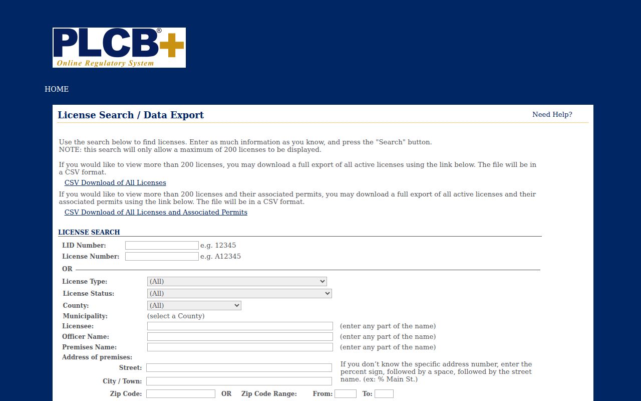
The screenshot shows the official portal's ZIP-capable premises-search route. It is useful only for the limited licensed-premises question the portal supports, not for identifying people throughout a Lower Allen Township ZIP code.
Lower Allen Township USPS Proof
USPS is the delivery authority for these postal checks. The research specifically directs readers to verify a real Lower Allen address with the address-based lookup before publishing a claim that a particular street uses 17011, 17055, or 17070. This protects against an easy error: treating a postal-community label as a map of Township jurisdiction.
The USPS ZIP Code Lookup provides the official starting screen for postal confirmation. Supply the complete address when the question is delivery-specific. The city-and-state entry view is useful for orientation, but the address result is the evidence route for an individual delivery point.
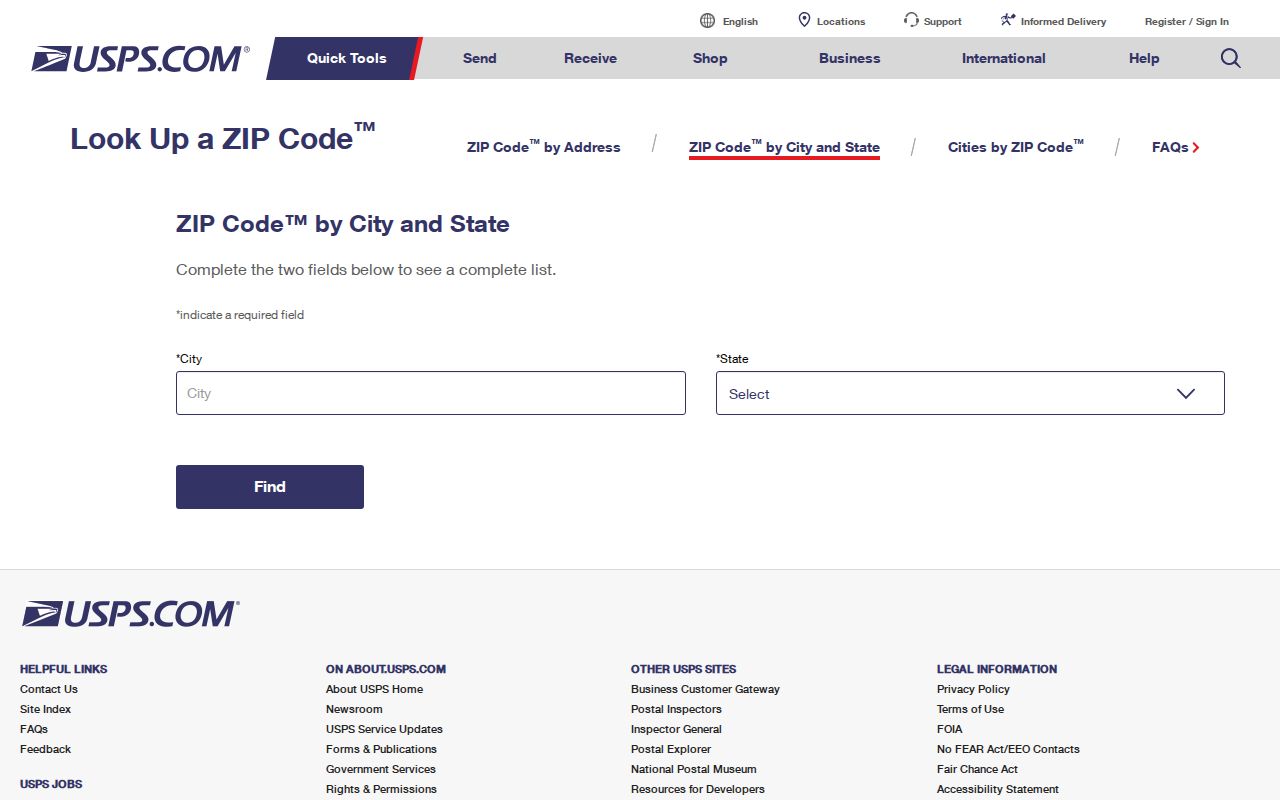
The screenshot shows the USPS lookup interface used to confirm delivery geography. After it supplies the ZIP, shift to County GIS for the parcel and municipal field instead of treating the postal result as a property or resident record.
Lower Allen Township Address Forms
Some address terms appear alike but serve distinct functions. A ZIP+4 adds delivery sorting precision to a ZIP code. It does not identify a municipal boundary. A PO-box ZIP routes mail to post-office boxes and does not locate a building. A unique ZIP is assigned to one organization or delivery purpose when USPS uses that arrangement. A carrier route is the delivery route used to organize mail distribution, not a parcel-boundary map.
- ZIP code
- A USPS routing code for delivery. It should be checked against the full address when the exact route matters.
- ZIP+4
- An added four digits that refine mail sorting for a delivery segment or point. It is not a municipal or property identifier.
- PO-box ZIP
- A ZIP used for post-office-box delivery. It identifies a mailing arrangement rather than the situs of land.
- Unique ZIP
- A ZIP assigned for a particular organization or delivery use. It should never be assumed from a town name.
- Carrier route
- A postal delivery sequence. It is useful for mail operations but not a legal description or Township-boundary field.
For a land question, replace postal terminology with the parcel, UPI, or legal description as the search moves from delivery to title. Cumberland's UPI certification connects the assessment identifier to many conveyances and plans, while Recorder documents carry the recorded land description.
Lower Allen Township ZIP History
Postal geography is only one part of a historic place search. The Pennsylvania State Archives describes Lower Allen as incorporated from Allen Township in 1849, while local history places the Upper and Lower Allen division around 1849 or 1850. Earlier records may use Allen Township even when the land is in present-day Lower Allen. The Village of Lisburn and older locality names such as Milltown and Eberly's Mills can also appear in catalogs and historical records.
For an old address, do not force current delivery geography onto a record that predates the postal or municipal wording being used. Start with the historic locality and land description, then check County Archives, Township minute books, Recorder material, or local historical collections for the date in question. The State Archives guide lists Lower Allen minute books for 1851 to 1914 and 1933 to 1990, with no listed minute-book roll for 1915 to 1932.
Lower Allen Township ZIP Limits
ZIP codes organize delivery, not people. No verified county or Township portal here supports a general ZIP-wide resident search. Property Mapper accepts address, PIN, deed book and page, point-address, and sales-transfer criteria. AxisGIS is verified for owner, address, parcel ID, Identify, and abutting parcels. LANDEX is verified for recorded-party and document fields. UJS has a ZIP field in Other Criteria, but court search is not a ZIP directory.
Likewise, a postal label does not prove ownership, voter registration, school assignment, or every person at a location. For a record that is unavailable or protected, stop at the custodian's boundary. Pennsylvania's Address Confidentiality Program may provide an eligible participant with a substitute address, and restricted court, vital, and motor-vehicle records remain outside a ZIP-based search.
Use the proper authority for corrections: USPS for delivery information, County GIS for parcel and municipal geography, Assessment for assessment data, the Recorder for recorded land records, and Lower Allen Township for local municipal records. That division makes the postal guide useful without overstating what a postal code can show.