
Trace Lower Allen Township Streets
A Lower Allen Township address trail is most reliable when it follows the public record sequence, not when it assumes an address produces a household roster. Cumberland County Property Mapper accepts a physical address and can open the mapped parcel and assessment context. Lower Allen AxisGIS adds address, owner, and parcel-ID searches for the Township. Those results give a starting parcel, not proof that every person connected with the street lives there. Move from that land identity to the recorded document trail, then use a separate, regulated election-record route only when it fits the question.
- Enter the physical address in Cumberland County Property Mapper or use Lower Allen AxisGIS when an owner or Township parcel ID is already known. Note the displayed parcel identity, municipal field, parcel boundaries, and any deed book and page clue.
- Use the parcel or UPI as the stable link. Check the assessment context with Cumberland Property Assessment when an ownership name needs confirmation, because the county has warned that some school tax bills showed incorrect ownership names after a computer update.
- Take the deed book/page, named party, or legal description to LANDEX. The street number begins the work, but a title chain follows recorded parties and the legal land description.
- For a lawful voter-record question, use the personal status tool for an individual or request the regulated Cumberland street list through the official state form. It is not a map-browse function or a public web list.
- For an older address question, compare recorded title with dated Township minutes, county archival material, and an actual title-specific historical source. Search the earlier Allen Township name where the date calls for it.
That sequence separates physical geography, assessment administration, recorded land history, and election information. It also keeps an owner name from being overstated as evidence about all residents of a Lower Allen Township address.
Lower Allen Township Street Fields
Property Mapper and AxisGIS serve related but different roles in a Lower Allen Township street directory search. Property Mapper is the countywide tax-mapping tool. It supports a physical-property search and supplies a left-side assessment panel after a parcel is selected. AxisGIS is the Township viewer. Its official help sheet confirms distinct Owner, Address, and Parcel ID modes, plus Identify and Find Abutters. Use the actual field that matches the fact in hand rather than carrying a name or address from one system into another as if their results were identical.
| Portal field or control | Route | Verified use | Street-search limit |
|---|---|---|---|
| Property Address | Property Mapper | Partial physical address; county configuration also exposes Address 2 and municipality. | Finds parcel context, not a household list. |
| PIN | Property Mapper | Partial county parcel identifier search. | Does not establish who occupies the parcel. |
| Deed Book and Page | Property Mapper | Bridges a recorded reference to the parcel map. | Use the Recorder for the document itself. |
| Sales & Transfers | Property Mapper | Date, price, property type, municipality, and address-contains filters. | Sales context is not resident evidence. |
| Owner, Address, Parcel ID | Lower Allen AxisGIS | Official Township search modes for locating a subject parcel. | Each returns parcel-associated information, not all people there. |
| Identify and Find Abutters | Lower Allen AxisGIS | Select a parcel, then identify adjoining parcels. | No radius or distance filter was verified. |
The county also documents pan and zoom, a point-address geocoder, a Locate Me control, selected-parcel popup, print widget, and imagery layers. Those controls are useful for recording a parcel's visual context. They do not turn the map into a Lower Allen street-by-street list of residents.
Lower Allen Township Address Keys
Four address terms prevent common mistakes in a street directory search. The County's property and recording systems connect them, but they are not interchangeable. A street number can change or be absent from an older land record. A legal description and county parcel identifier are often better anchors when tracing a lot through a subdivision, conveyance, or estate transfer.
- Parcel
- A mapped tract of land used in county assessment administration. Its boundary and identifier help connect a Lower Allen Township address to tax and mapping records.
- Situs address
- The physical street-number location of the parcel or building. It tells where the property sits, not where an owner receives mail.
- Legal description
- The recorded land identity, such as a lot, subdivision, or metes-and-bounds description. It is the stronger bridge between a deed and the same land over time.
- UPI
- The Uniform Parcel Identifier, Cumberland County's assessment identifier for a land parcel. Assessment certifies it on many conveyances, plans, mortgages, and related instruments.
Cumberland says its UPI charge became $20 per parcel on January 1, 2025. That is a certification charge, not a claim that the UPI identifies current occupants. A tax mailing address may differ from the situs address, and the research did not verify an online mailing-address display on an individual Property Mapper card.
Lower Allen Township Street Records
Different records answer different address questions. The county map helps place the parcel. The Recorder connects named parties to land instruments. Township files can tie an applicant or owner to a particular project. None should be promoted into a universal roll of who lives along a Lower Allen Township street. The coverage below makes the evidentiary boundary visible before a name is carried from one source to the next.
| Address record | Custodian | What it can establish | Access route |
|---|---|---|---|
| Property Mapper parcel | Cumberland GIS | Parcel geometry, property address, selected assessment fields, imagery context. | Free county map by address or parcel. |
| AxisGIS parcel | Lower Allen Community & Economic Development | Owner, parcel ID, or address route, parcel details, and adjoining-parcel sequence. | Official Township viewer. |
| Assessment roll | Cumberland Property Assessment | Assessment administration and ownership-name treatment subject to correction. | Public inspection at One Courthouse Square, Room 104. |
| Recorded deed | Cumberland Recorder of Deeds | Recorded parties, document date and identifier, and legal land description. | LANDEX or Recorder counter. |
| Plan and subdivision maps | County Planning, GIS, and Recorder | Lot, block, subdivision, or development-timing context. | Planning Review and Subdivision Activity maps, plans, or Recorder records. |
| Township permit file | Lower Allen Community & Economic Development | Publicly releasable applicant, owner, address, work, or chronology evidence. | Defined department request or RTKL route. |
For a street-wide question, map the contiguous parcels first. The County Planning Review Map can compare parcels, land use, zoning, and agricultural preservation. The Subdivision and Land Development Activity Map can use municipality, date, plan-name, and street-address filters. Both explain physical or development context, not personal occupancy.
Note: A selected owner field or recorded party identifies a land-record connection, not every adult, child, guest, or other lawful occupant at that address.
Lower Allen Township Deed Trails
The Recorder's street trail is a legal-description trail. Cumberland says deeds reach from 1750 to the present, while mortgages are stated from 1973 and miscellaneous records from 1956. Start with the current owner or an identifier supplied by assessment data, find the acquisition record, and capture its grantor, grantee, recording date, instrument number or book/page, document type, and legal description. Search the prior owner as a grantee to continue backward. Match lots and descriptions, especially where a subdivision, partition, or changed street number could make a bare address misleading.
The LANDEX Document Publishing Search uses Cumberland selection, party or company name, first name, date range, document type, instrument number, or book and page. The interface supports wildcards, but caps name matches at 250 and asks a person searcher to enter something in First Name. Its search and access treatment can depend on the account, cart, or document requested, so it is inaccurate to call every image freely available.
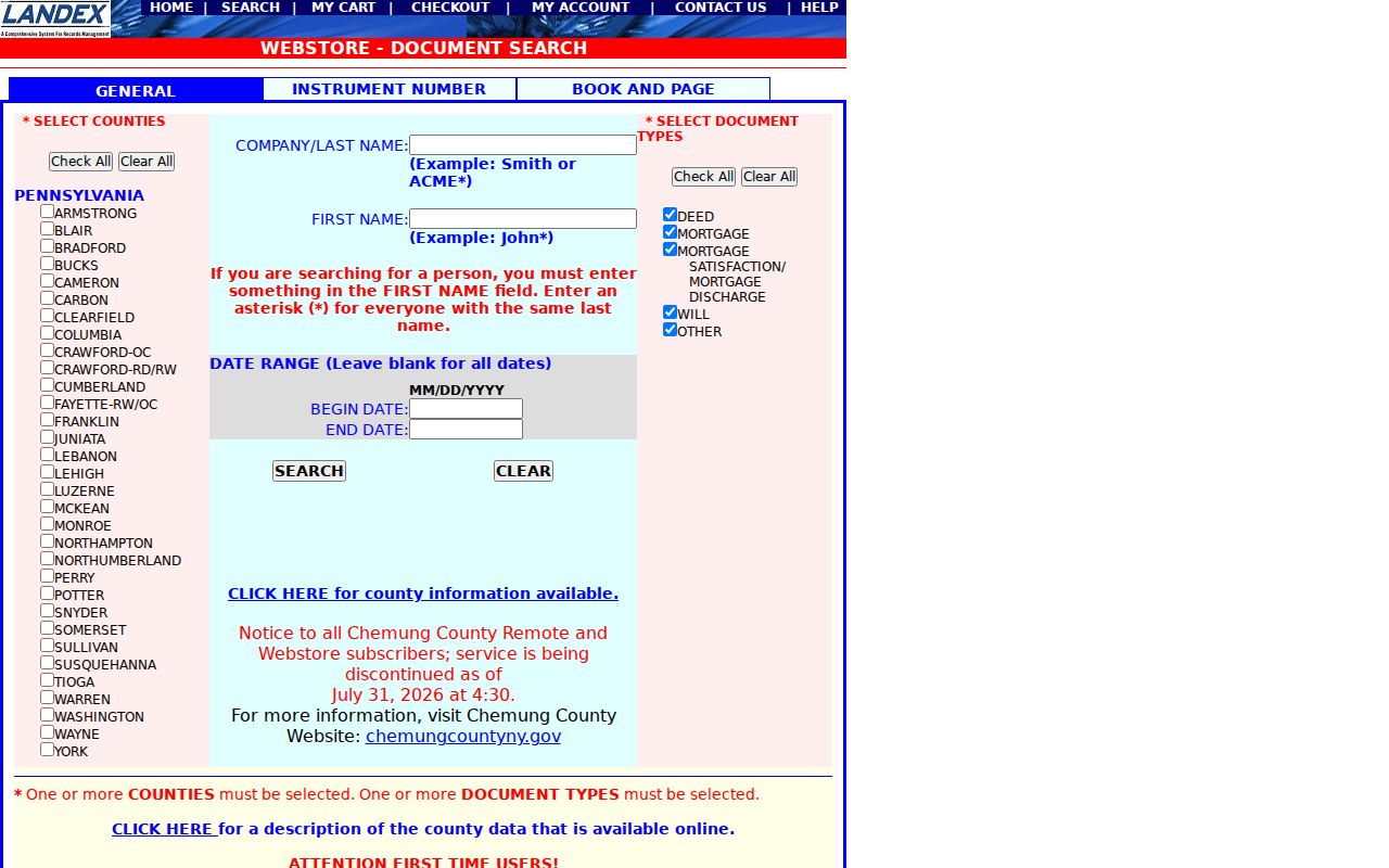
The screenshot shows the Cumberland-selectable LANDEX search route. It illustrates why a street directory researcher needs a parcel or recorded-party bridge before looking for a deed, because the verified general interface is not an address-search field.
Recorder counter research remains available when the online route is incomplete. The office is at 1 Courthouse Square, first floor, Carlisle, and asks visitors to schedule appointments. The Recorder lists record-research hours of 8:00 a.m. to 3:30 p.m., while office hours are 8:00 a.m. to 4:00 p.m.
Lower Allen Township Permit Files
A permit file can date work at an address, but it is a request-based record trail rather than an online street directory. The Township Permit Center is a document and application library with a filename search, not a public search of issued permits by address. The current General Permit Application asks for property location, owner and applicant information, project category, description, contractor details, supporting material, payment, and certification. An application is not evidence that approval issued, and an applicant is not automatically a current resident.
For an existing, identifiable file, contact Lower Allen's Open Records Office at 2233 Gettysburg Road, Camp Hill, or submit the current Pennsylvania Office of Open Records form through the Township portal, by email, mail, or in person. Name the address, date range, permit number if known, and record class requested. The Pennsylvania Right-to-Know Law seeks existing records, not an agency-created answer to who formerly lived at an address. Lower Allen reports the usual five-business-day response period, with a properly noticed extension where allowed.
Police audio or video has a separate Act 22 process rather than the ordinary RTKL process. That distinction keeps an address request narrow and directed to the record custodian that actually holds the material.
Lower Allen Township Voter Lists
Pennsylvania separates personal voter-status confirmation from street-level public-information products. Find Voter Registration Status is an individual path with First Name, Last Name, County, and Date of Birth. It is not an open Lower Allen Township street directory, and a web non-match does not prove that a person is not registered. A voter may also contact the county registration office or call 1-877-VOTESPA.
The official Department of State request form is the documented route for a Cumberland County Street List. It costs $20 per county and is delivered electronically after a signed affirmation. Its specified street-list fields are name, residential address, mailing address, party, and active or inactive status. A Walking List omits mailing address. The request form prohibits internet publication and imposes statutory use restrictions, so it is not material to copy into a public page.
The Pennsylvania voter-status form is the official personal check shown here. Its role in a Lower Allen Township street directory is limited to authorized individual confirmation, not a searchable neighborhood roster.
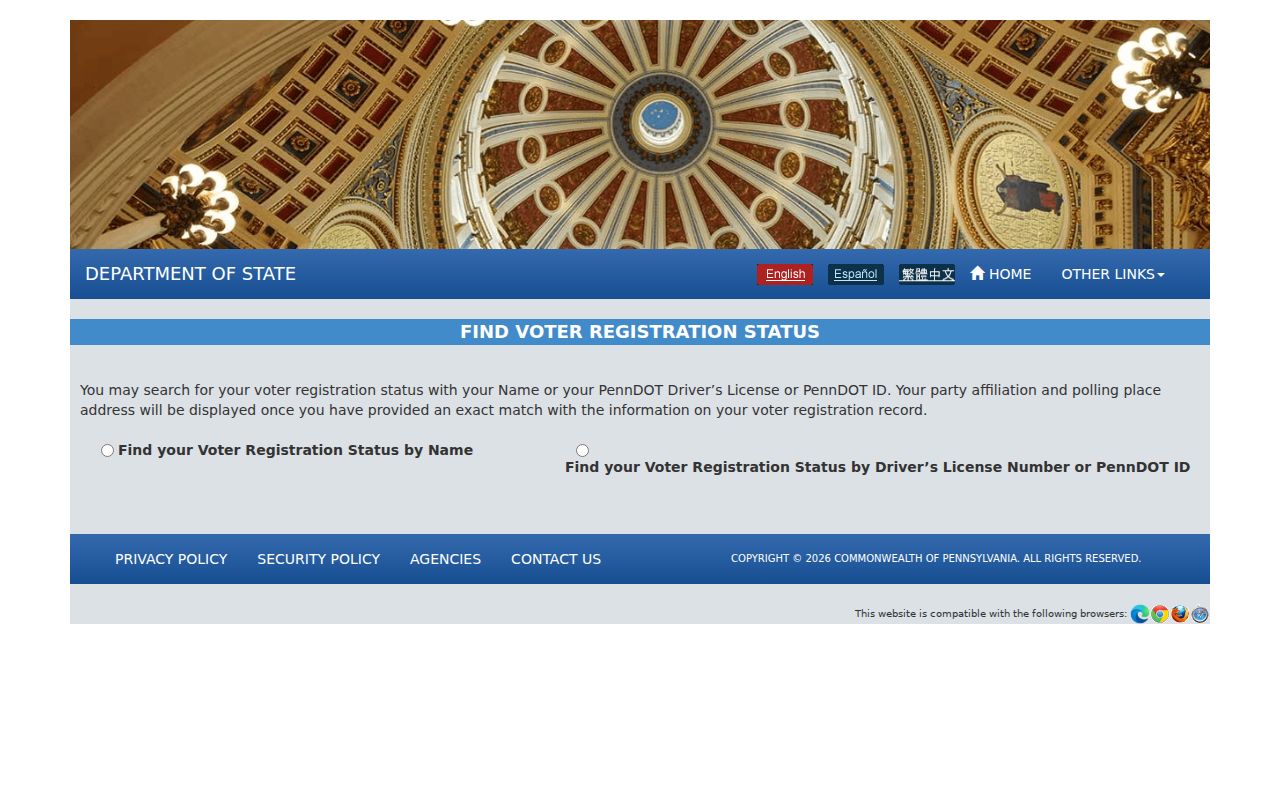
The form reinforces the separation between individual status verification and a regulated county list request. Cumberland County Bureau of Elections maintains registration records at 1601 Ritner Highway, Suite 201, Carlisle, where public records are available for inspection under staff supervision.
Note: Protected-address participants may use an Address Confidentiality Program substitute address, so an altered or absent address must never be reverse-engineered.
Lower Allen Township Owner Limits
Property Mapper, AxisGIS, assessment records, and LANDEX describe parcels and recorded land connections. A mapped owner can be an assessment field. A grantor or grantee is a party to a recorded instrument. Neither label supplies a dependable answer about every person who lives at an address, receives mail there, or has a protected address. The research did not verify a lawful public list for utilities, motor-vehicle addresses, unlisted household members, or all non-owner occupants.
Use the smallest record that answers the real question. A parcel map is right for boundaries. A deed is right for a recorded transfer. A permit request can be right for a defined construction file. A voter list is governed by its separate law. Combining these sources still requires care because they may relate to different dates and different people.
Lower Allen Township Historical Titles
Historic work needs a wider title and jurisdiction search. Pennsylvania State Archives describes Lower Allen as incorporated in 1849 from Allen Township, while local history describes the division around 1850. Search both Lower Allen and Allen Township when a record predates the present label. The digitized municipal guide lists Lower Allen minute books for 1851 to 1914 and 1933 to 1990, a partial ordinance book for 1948 to 1959, and resolution books for 1952 to 1966. The listed minute-book gap from 1915 to 1932 is a gap in that digital guide, not proof that all local history disappeared.
Cumberland County's land records begin in 1750. For earlier territory, County Archives advises checking Lancaster County, because Cumberland was formed from Lancaster. County Archives also holds non-active permanent records, generally from before 1950, and its 2024 and 2025 digitization additions include land surveys, warrants, election returns, Recorder oaths, estate tax liens, and vendues. Those are historical-title leads, not a verified reverse address directory. When a current parcel narrows the place, use dated minutes, plans, tax books, or archival sources to test continuity.
A person-specific modern question belongs in the Lower Allen Township resident lookup path, where independent record types can be compared without turning a street trail into a claim about a whole household.
Lower Allen Township Street Limits
A by-street search can identify public parcel and recorded-document paths, but it cannot make a final residence claim from one field. The County's GIS and the Township's AxisGIS serve physical geography and parcel administration. USPS handles delivery routing. Assessment administers parcel records. The Recorder holds instruments and legal descriptions. Election records are governed separately. When the question changes, change the custodian too.
Correct an apparent property-record error through Cumberland Property Assessment or the original custodian. Seek an identifiable Township record through the Open Records Officer, and use the Pennsylvania Office of Open Records appeal route when a RTKL denial or deemed denial requires review. Respect restricted court, vital, motor-vehicle, and confidential-address records rather than attempting to fill a missing result from less reliable sources.